SLAC Scientists Search for New Ways to Deal with U.S. Uranium Ore Processing Legacy
New Field Project Tests Link Between Organic Materials and Persistent Uranium Contamination
Researchers at the Department of Energy’s SLAC National Accelerator Laboratory are trying to find out why uranium persists in groundwater at former uranium ore processing sites despite remediation of contaminated surface materials two decades ago. They think buried organic material may be at fault, storing toxic uranium at levels that continue to pose risks to human health and the environment, and hope their study will pave the way for better long-term site management and protection of the public and environment.
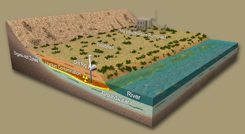
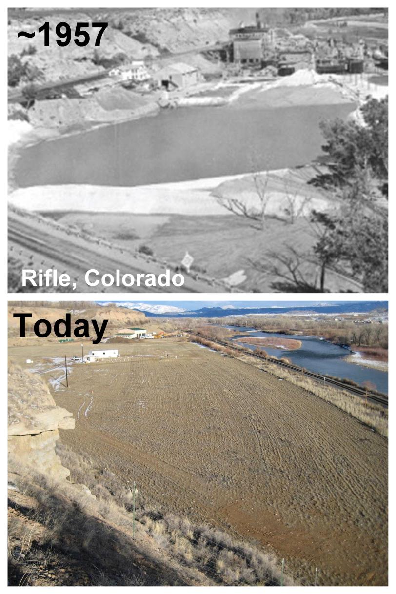
The contaminated sites, on floodplains in the upper Colorado River basin, operated from the 1940s to the 1970s to produce “yellowcake,” a precursor of uranium fuel used in nuclear power plants and weapons. In the 1990s, site surfaces were cleaned up, and remaining uranium in the ground was expected to flush out over time due to natural groundwater flow across the sites.
“Uranium dissolved in groundwater flows slowly into nearby rivers, where it becomes diluted below the uranium concentrations naturally present in river water,” says John Bargar, SLAC’s project lead and researcher at the lab’s Stanford Synchrotron Radiation Lightsource (SSRL), a DOE Office of Science User Facility. “However, studies have shown that the groundwater contamination is unexpectedly long-lived.”
Buried Organic Material Stores Uranium
But why is this pollution so persistent? To find out, Bargar’s research group recently joined forces with the DOE Office of Legacy Management, which is in charge of the contaminated sites. “Our collaboration is motivated by the need to better understand the geochemical and biological factors influencing uranium mobility and transport,” says William Dam, a hydrologist and site manager at the Office of Legacy Management. “We want to understand the way uranium gets from the ground into the groundwater, creating a plume of contamination in which uranium concentrations stay above regulatory safety requirements.”
Previous field research by Bargar’s team and others at the site of a former uranium mill in Old Rifle, Colorado, has provided a possible explanation for the longevity of the uranium contamination. It revealed that up to 95 percent of the subsurface uranium is concentrated in zones of organic-rich sediment – the buried remains of plants and other organisms along former Colorado River stream banks – generally located 10 to 30 feet underground. These organic substances appear to store large amounts of uranium, restricting its mobility and releasing it very slowly into the surrounding water over many years. Current estimates predict that the contamination will not flush away for at least another 100 years at several sites.
Collaboration Enables Region-wide Testing
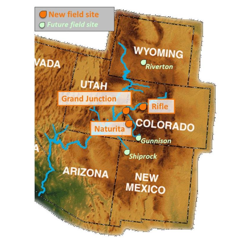
“Our model for Old Rifle predicts that organic-rich zones may generally influence uranium mobility throughout the upper Colorado River basin and therefore could also play an important role at other sites,” says Bargar. As highlighted in the latest Office of Legacy Management Quarterly Report, the new project will include five additional sites in Colorado, Wyoming and New Mexico. The field work started from August to October last year at four sites, and more sample-collecting expeditions will follow this spring.
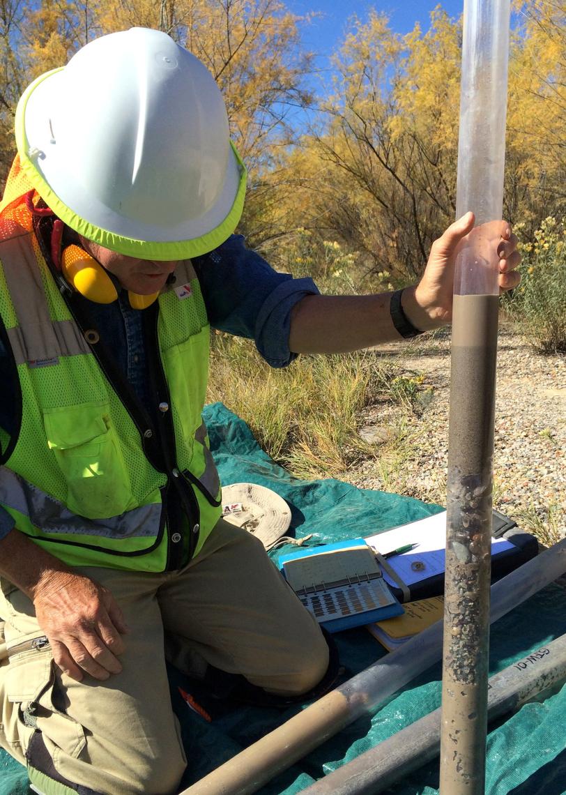
For Bargar, the collaboration with the Office of Legacy Management is a key factor in the success of the project. “Access to those sites is regulated, and some of them are in very remote locations,” he says. “Our partners from the Office of Legacy Management provide us with site access and logistical support. They also carry out the drilling operations required to take sediment and water samples.”
X-ray Studies of Chemical and Biological Factors
Samples from the field work are shipped to SSRL, where Bargar’s team will analyze them with a variety of X-ray techniques. Scheduled to begin in late January, these experiments will determine the chemical form of uranium in samples from various depths. Some forms of uranium dissolve better in water than others, and the study can reveal how the presence of particular chemical forms in organic-rich zones affects overall uranium mobility at the contaminated sites. The study will also investigate the types of organic carbon present in the ground to help understand how it influences uranium behavior.
The researchers will combine the X-ray data with studies of how bacteria affect uranium chemistry. “We know that microbes strongly influence the chemical form of uranium and, hence, its mobility,” Bargar says. “By collecting information about microbial populations present in the sediments, we hope to gain information about how and when bacteria do that, and how bacteria couple subsurface carbon chemistry to uranium behavior.”
A deeper understanding of the various factors controlling uranium mobility could potentially lead to better ways of cleaning up the nation’s legacy of contamination from uranium mining and processing, and may help researchers devise new remediation strategies for contaminated sites in the upper Colorado River basin and elsewhere.
Bargar’s research is funded by the Subsurface Biogeochemistry Research activity of the DOE Office of Biological and Environmental Research, Climate and Environmental Science Division, which is interested in fundamental biological and geochemical processes controlling the behavior of uranium and important related subsurface constituents such as organic carbon. The field project involves additional team members from the Lawrence Berkeley National Laboratory.
For questions or comments, contact the SLAC Office of Communications at communications@slac.stanford.edu.

Related stories